Skip to content The Trail Center

Project (click for directions): Hidden Villa - Los Altos Hills

Long Bunny Loop Trail

Activities: on the inaugural work day in our partnership with Hidden Villa's staff and volunteers, we will work to restore tread width on a portion of the Long Bunny Loop Trail near a fork of Adobe Creek. This will require removing slough and/or cutting the inside edge of the trail, installation or replacement of small retaining walls, and some gentle brushing (vegetation trimming).

In the event that significant rain is expected, the event will be postponed to a future work day. Volunteers should expect an email with such an announcement or can check the Trail Center website for updates.

Volunteer

The Hidden Villa farm and open space was founded by the Duveneck family in 1924. From the Hidden Villa website:

Hidden Villa is a nonprofit educational organization that uses its organic farm, wilderness, and community to teach and provide opportunities to learn about the environment and social justice.  Hidden Villa stretches over 1600 acres of open space in the foothills of the Santa Cruz Mountains, about 40 miles south of San Francisco. Our mission is to inspire a just and sustainable future through our programs, land and legacy.

Open to the public, Hidden Villa is enjoyed by hikers, families, day campers, and school groups. It offers several miles of trails on the property and connections to the Rancho San Antonio and Monte Bello Open Space Preserves.

Location:  26870 Moody Rd, Los Altos Hills, CA 94022

Directions:

Trail Center will make arrangements so that volunteers are not required to pay for parking on the work day.

From San Francisco and the Peninsula: Take I-280 South to exit 16 towards Moody Rd. Bear left to stay on El Monte Rd for .5 mile until the intersection with Elena Rd. Turn left onto Moody Rd and continue 1.7 mile until the entrance of Hidden Villa on the left. Turn left to take the driveway, passing the gatehouse, about .2 mile and turn into the main parking lot on your right.

From San Jose and the Valley: Take I-280 North to exit 16 for El Monte Rd. Keep left at the fork for El Monte Rd west, follow signs for Moody Rd/Foothill College and merge onto El Monte Rd.  Continue about .7 mile until the intersection with Elena Rd. Turn left onto Moody Rd and continue 1.7 mile until the entrance of Hidden Villa on the left. Turn left to take the driveway, passing the gatehouse, about .2 mile and turn into the main parking lot on your right.

Project Lead: Judd Volino

Additional Information: Participants should bring water, sunscreen, sturdy shoes, lunch and normal precautions against poison oak exposure (work gloves, long sleeved shirts and long pants). The Trail Center provides tools, training, gloves, and refreshments after the workday.

Project: Sugarloaf Mountain Open Space - City of San Mateo

Photo Albums: 1709-09 Sugarloaf Mtn PO Abatement and 1709-16 Sugarloaf Mountain

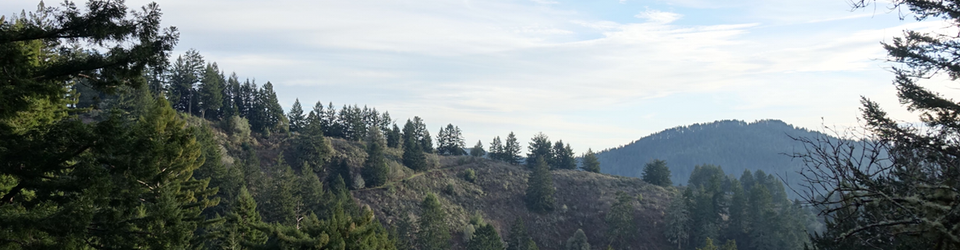
The Trail Center added to its list of new trail construction projects with the start of work on “Segment 3” at the City of San Mateo’s Sugarloaf Mountain open space, which adjoins Laurelwood Park. Segment 3 refers to a conceptual route from Sugarloaf’s master plan. This route will allow for a connection between the “grand junction” of several fire breaks/roads on the west side of the park and a switchback of the Amphitheatre Trail. This project will replace the lower two-thirds of an illegally built and poorly sited trail and bring the upper third of that trail up to a sustainable standard for grade and drainage.

Trail Center began the process of realizing this trail by collaborating with the city’s Park Planning Administrator Greg Meek to identify viable projects in the master plan in the fall of 2016. In January 2017 volunteers, including Dave Croker, Kathy, Judd and Bill, conducted several scouting trips to evaluate possible corridors, resulting in a flagging of “control points” for a proposed path. Greg Meek then made several visits to walk the path at various points in the spring and early summer to ensure there were no plant species of concern in the corridor.

In September, Kathy, Judd and Dave C. returned to the corridor and were happily surprised to find most of the flags from the winter were still in place. They made a few tweaks and added more intermediate flag to clarify the route.

On September 9, “Poison Oak Team 8,” consisting of Frank F and Frank H, Tom, Tim, Karl, Kathy, Judd, and Dave C (running Shindaiwa gas trimmer) worked to clear the corridor of significant stands of poison oak. Much appreciation goes out to this crew for being willing to take this on. Several of us donned the Tyvek bunny suits. We were able to complete the work by early afternoon. Frank H and Karl get special recognition for carrying the emergency water tank on their backs while following Dave.

On September 16, we hosted a work day for general volunteers. The main goal was to complete the remaining brushing and duffing required for the new corridor and to build a narrow starter tread. We were thankful the temperatures crested in the lower 70s, with the clouds lifting to reveal full sun as the day progressed.

We staged the trailer on the paved trail east of the restrooms in Laurelwood Park. We had a great turnout of around 25 volunteers, including a very game group of teenage boys. We all hiked to the use trail via the Salson Trail.

Dave Taylor’s crew worked on the segment that includes a switchback north of the existing trail. This segment passes through a mixture of meadow and mature oaks. They were able to remove a lot of duff from the future tread area, remove some remnant poison oak, and brush back their upper most segment. The teenagers did a bit of widening of a portion of the use trail that we’ll be incorporating into the final route.

Hank and his team of largely seasoned volunteers worked on the portion between the gully and the use trail. They continued behind Dave T’s crew to work on rough benching of that section, leading up to the first switchback.

Aaron’s crew worked on the south side of the gully, including around the turn with the oak/buckeye intertwined and on the oak and bay-shaded hillside. They completed lots of brushing and duffing. They had the most challenging terrain, as the corridor is on a steep hillside at that point. But the volunteers dug in their heels and completed the initial bench cut.

Finally, Bill’s crew worked duffing and brushing the southernmost segment. This segment has a few short stretches between trees that we’ll have to finesse and possibly supplement with some retaining walls to get a good grade and solid bench, but the crew got a great start. As is our convention, we did not clear the first 50 yards or so of trail from the future trailhead to discourage use before the trail is ready.

We’ll wait until after the winter rains have added more moisture to the soil to work on creating the full width and lateral grade for the tread. Also ahead is reworking the use trail that connects to an Amphitheatre switchback and completing a small switchback where the new route joins the use trail. We’ll also consider a potential structure for crossing the gully, and a design for the trailhead, which crosses a fire road drainage ditch.

Thanks to Larry for bringing snacks and drinks and to Kathy for volunteer coordination and helping Judd get the trailer out the east end of the park. Thanks also to Helen and Karl for contributing photos to the album.

Judd Volino
9/23/2017

Project: San Mateo Memorial Park - Mt. Ellen Trails

Photo Album: 1708 - Memorial Park

On Saturday, August 19, we returned to San Mateo County’s Memorial Park to work on the Mt. Ellen Summit Trail, continuing both above and to the west of the work completed on the May 13, 2017 workday.

The weather was clear, with temperatures in the low 50’s at the outset and the high 70’s when the workday ended. The trail tread is soft Doug fir and redwood duff or a mix of organic and sandy soil made workable by last winter’s rains. The work area was almost entirely under tree cover. Our 24 volunteers included a nice mix of experienced and first time volunteers

As on previous workdays, we staged the trailer and volunteers parked in the lot immediately before the park entrance kiosk. Thanks to Rangers Dave Vasquez and Matt Auda-Capel for reserving this area, providing lumber and stakes for the retaining walls, and coordinating with us on the work scope. We accessed the Summit Trail by hiking up the eastern end of the Mt. Ellen Nature Trail.

Dave Taylor’s crew began at the western junction of the Summit Trail with the Nature Trail and proceeded uphill to clean the inside edge, brush, remove roots, and improve drainage at two switchbacks, heroically fending off stinging yellow jackets at one location. Beginning 0.1 mile above the eastern junction of the Summit Trail with the Nature Trail, Hank’s crew installed a retaining wall to divide the upper and lower approaches of an eroding switchback, improved the switchback drainage, installed a retaining wall along a portion of trail that had slid off the hillside during the winter rains, restored the trail width and replaced a badly split fence rail. Above them, Judd and Larry’s crew followed in Judd’s Shindaiwa wake, brushing, defining inside edge, restoring trail width, and adding a switchback drain and drain dips.

Approaching the summit from the east and from the west, the plan was for the crews to meet and complete all Summit Trail work. The extensive undergrowth, however, did not allow this in the time available. The remaining work on the Mt. Ellen Summit Trail includes the portion from 0.1 miles west of the Pomponio Trail junction to 0.1 miles east of the junction. The scope includes brushing, restoring tread width, and adding drains at switchback drains and drain dips, estimating a crew of 15 volunteers to complete in one workday.

Thanks to Dave Taylor for driving the trailer, to Kathy for coordinating and signing in our volunteers at the beginning of day, and to Larry for catering the snacks and beverages at the end of the day.

Bill Farrell
9/23/17


Project: Lake Tahoe Basin Management Unit - United States Forest Service

Photo Album: 1707-20 Incline Flume Trail

For our annual trip to the Sierras, the Trail Center partnered with  with Friends of Incline Trails (FIT), Tahoe Rim Trail Association (TRTA), and Tahoe Area Mountain Biking Association (TAMBA) to continue work on the Incline Flume Trail, near Incline Village, Lake Tahoe, Nevada.

Ten volunteers set up camp in a not-so-backcountry location behind the lodge at Diamond Peak Ski resort. We worked on crews that combined Trail Center and local volunteers, which provided a great opportunity to share skills and experiences. The weather was sunny, but a bearable temperature.

Trail Center is acknowledged in the FIT August 2017 newsletter. You can also see some of us at work in the segment of this Tahoe Fund (a backer of FIT) video:

Read more about the Tahoe Fund's role in Incline Flume Trail project on their site.

Project: San Mateo Memorial Park - Mt. Ellen Trails

Photo Albums: 1705-13 Memorial Park and 1703-29 Memorial Park Scouting

Our efforts to improve the Mt. Ellen trail network in San Mateo County’s Memorial Park continued on our Saturday, May 13, 2017 work day, which was focused on the Mt. Ellen Summit Trail. Bill Farrell identified this area as needing attention in the summer of 2016, and after our wet winter, the trail in some places was at risk of going back to nature with overgrowth.

As we had when we worked on the Mt. Ellen Nature Trail last September, we staged the trailer and volunteer parking at the lot immediately outside the main entrance of the park. Thanks to Ranger Dave Vasquez for taping off the area (and for coordinating with us on the work along with Ranger Matt Auda-Capel).

Our 15 experienced volunteers were greeted with clear skies and cool temperatures. The trail is mostly covered by a fir, oak, bay, and redwood canopy, and the soil has an organic texture that holds moisture without being mucky. We accessed the Summit Trail by hiking up the eastern end of the Nature Trail and started at the junction of the two trails near the “N” post.

We were excited to have Dave Taylor back on the job as a crew leader, and his crew began at the junction and covered the entire leg to first switchback, cleaning the inside edge, brushing, removing roots, and cleaning out a stretch bounded by a railing. Later they leap-frogged to two other sections. Crew-leader-in-training Karl Mosgofian’s team took the next leg, working to restore good drainage at the first switchback, scraping off much low vegetation from the tread and removing lots of soil from the inside edge to bring back the tread width. They moved on to several more sections before the day was out. Hank Magnuski’s crew was at the front initially and helped restore more bench at the next switchback where the outside edge had been lost in the turn. They also moved a lot of soil in the turn on their leg and took the opportunity to heavily cut back shrubs on the uphill side of the trail to ensure a clear corridor for years to come.

In several cases, as crews leap-frogged, volunteers were able to do a second pass on the trail to further improve the tread. After lunch, this all-pro team seemed to get a second wind and covered much more footage than you’d expect from this few people. We reached a more open section where lots of grass was growing and cleared that, concluding near the hairpin turn where the trail begins its westward run on the ridge. In total, nearly every foot of about 1/4 mile of trail was touched in some way to bring it back to standards.

We have enough work left that it will probably make sense to use our planned August 2017 return to Memorial to complete maintenance of the Summit trail. And there are a couple spots from the work day where we might want to follow up: possibly adding a retaining structure around the roots of a large Douglas fir where there’s not much bench left, and replacing a cracked railing on the first leg..

Thanks to Kathy Diamond, our volunteer coordinator, who ensures volunteers get good communication about the work day and manages sign-in, and to Larry Stites who provided the always welcome post-work snacks and beverages. Finally, we wouldn’t have had tools without the continued willingness of Dave Taylor to drive the trailer, which always seems to provide an extra challenge (in this case, it required hard-wiring the lights harness).

Judd Volino
5/18/17

The Tahoe Rim Trail Association (TRTA) along with Tahoe Area Mountain Biking Association (TAMBA) and Friends of Incline Trails (FIT) are working on a project (started last year, will likely continue at least into next year) to open a historical flume route in the Lake Tahoe Basin Management Unit of the USFS as a multiple-use trail between Mt. Rose Highway above Incline Village and the northern edge of Lake Tahoe Nevada State Park at Tunnel Creek Road.

Note: This project was originally incorrectly listed as being in Humboldt-Toiyabe NF.

From the FIT website:

The “Incline Flume” trail is located above Incline Village and is primarily accessed from Mt Rose Highway (Hwy 431). It has also become popular as a loop from Diamond Peak up the Tyrolean Trail and back down Diamond Peak.

This is a relatively flat trail, remaining at approximately the same elevation throughout (7600 ft). There are beautiful spring wildflowers and some spectacular views of Lake Tahoe.

It is popular with trail runners, mountain bikers, walkers and hikers - of all ability levels - and used by locals, visitors, by families and individuals.

The route runs along what used to be a “flume” for commercial logging in the Lake Tahoe basin during the late 1800’s. There are still some remnants of the original flume structure.

For more details on the project, see the page on Friends of Incline Trails website.

Here is a track that roughly shows the trail's route.

Location: Earlier information about the possibility to camp at Mt Rose Campground should be discarded. The Mt Rose campground will not open: "This campground will not open during the 2017 camping season due to facility damage, hazard trees”.

We will instead camp at the Diamond Peak Ski Area. The ski area is owned by the Incline Village General Improvement District - a quasi government organization. Camping is at about 6700’ elevation, outside the main lodge. They will open the restrooms for our use. Due to potential last-minute changes in plans, volunteers are encouraged to check the Trail Center website before departure for any final information on our camping location.

Directions: Take Interstate 80 East to Truckee then 267 to Incline Village. Use Routes 28, Country Club Drive and Ski Way Road to get to the Diamond Peak Ski Area. Diamond Peak is located at 1210 Ski Way, Incline Village, NV 89451. Park in the "lower" parking lot (Diagram below - click or tap to enlarge). Travel time will be 5 to 5 1⁄2 hours depending on traffic and stops.

Supervisor: Hank Magnuski

Project Lead: Sue Hughes (Friends of Incline Trails)

Additional Information: The USFS requires that each volunteer have the following personal protective equipment: a long-sleeve shirt, long pants, sturdy boots (no sneakers), work gloves and a hard-hat. The sponsoring organizations may be able to supply a hard hat if you do not already have one, but the other items are your responsibility.

Participants should also bring a small day pack to hold items such as water, lunch, snacks, sunscreen, sun-glasses, rain gear, camera, etc.

For camp and trail work consider the following items:

  • Tent or other packable shelter
  • Sleeping bag and pad - temps can get down to 30 at night
  • Eating utensils, plate, cup, bowl
  • Personal hygiene items - this is a back country trip, so plan accordingly
  • Large water bottles or the equivalent - hydration is very important at this altitude
  • Sun screen - SPF 30 or better - you're two miles closer to the sun here. Don't forget your sunglasses, too.
  • Bug repellent - something with plenty of deet is best
  • Portable camp chair, if you have one


Project: Alum Rock Park - City of San Jose

Photo Albums: 1704 Alum Rock Park and 1703-26 Alum Rock Scouting

On Saturday, April 22, we returned to Alum Rock Regional Park to work on the South Rim Trail switchbacks above the confluence of North Penitencia and Arroyo Aguague Creeks. The trail has been closed due to slide damage and a large downed tree and root ball across the trail. (Original plans were to return to Sycamore Switchbacks Trail to complete the work begun on December 6, 2016, but two severe slides during the winter storms now require major engineering and reroute of the trail, and Sycamore will remain closed for the foreseeable future.)

The weather was mostly clear, with temperatures in the 50’s at the outset and in the high 60’s when the workday ended. Following winter rains, the soil was quite workable. The work area was almost entirely under tree cover.

Volunteers parked in the Youth Science Institute lot, and Ranger Huy opened the gate to allow Dave C with the tool trailer access to the staging area at Sycamore Picnic Grove, immediately adjacent to the Sycamore Switchbacks trailhead.

Approximately 30 volunteers helped make the day a success. Dave Kison and Ranger Valerie greeted the arrivals in the parking lot, distributing parking passes and collecting sign-in sheets before directing them down the ½ mile Penitencia Creek Trail to the base of the switchbacks. After another ¾ mile hike to the top of the South Rim Trail switchbacks, the work began. Aaron’s crew had the upper portion of the trail, brushing and widening the overgrown tread, removing outside berms, defining the inside bench, brushing overhead, and adding a couple drain drips. What a difference! Dave C’s crew (the Earthmovers) cut the trail into the hillside to divert around a slide (undercut by a fallen tree), improved the ramp onto SJ Park’s engineered solution through a tree root ball (where same tree had come to rest), and opened a scenic vista at a switchback where fallen trees had blocked the view and posed head hazards. The scope for Larry’s crew included brushing, definition of inside bench, inside drains at switchbacks, new drain dips, and one awesomely beautiful new viewpoint. The top of the trail served up a spectacular panorama for lunch, complete with a view of MC Hammer’s house (maybe).

The Trail Center believes that the trail can now be opened to hikers. Ranger Mike is considering what work the City may want to complete prior to opening (road grader removal of rock slide on Penitencia Creek Trail and possible improvements to a large retaining wall at the lowest end of the switchbacks). The Trail Center is also considering a return to Alum Rock later this year to complete the lighter work on the lower half of the switchbacks and to add a retaining wall to the aforementioned trail diversion.

Bill Farrell
4/22/2017

Project: Sugarloaf Mountain Open Space - City of San Mateo

Photo Album: 1703 Sugarloaf Mountain - Amphitheater Trail

After four consecutive cancellations due to regional rainouts, washouts, mud slides and road disasters, the Trail Center finally launched its 2017 season at Sugarloaf Mountain in Laurelwood Park of San Mateo City. We had a day of perfect weather and 37 (!) volunteers eager to start helping to repair the damage from this winter's wonderful storms.

Thanks to the suggestion of Kathy Diamond, we were able to find a workable venue that had easy access and repairable problems, a not insignificant task considering that many trails and access roads on our list are still closed. There were three main problems on the Amphitheater Trail (which the Trail Center constructed a few years ago) that needed our attention: mucky steps at the beginning of the trail, a mucky causeway further up and a super-mucky switchback that caused serious problems in proceeding up the trail.

We were fortunate to have three experienced crew leaders to direct our volunteers. Bill Farrell was assigned step repair, Dave Croker took on the switchback challenge and Luke Lempart handled everything else in the middle. We also wish to thank Larry Stites for again dealing with our after-work refreshments, Kathy Diamond for rounding up the volunteers, Justin Knowles for helping with the survey and Dave Croker for trailer hauling.

There are very steep steps at the beginning of this trail, and continuous water seepage was making the step surfaces slippery, muddy and unsafe. Drains would be difficult to do given the terrain, so a plan was made to top off each step with two or three inches of base rock that would provide for some drainage and at least improve the traction on each step. The rock would also provide a hardening for this very heavily used staircase. Kathy arranged for a ton of base rock to be delivered, and the City came through on the request. Midway, however, we thought we would be significantly short of material required, so Bill creatively mined nearby gravel and rock to supplement the fill used. These larger rocks greatly improved the potential drainage and strength of the stairs and by the end of the day the really hard working volunteers had filled and topped each step. The resulting improvement was dramatic.

Luke's crew handled a lot of drain cleanout and refurbishing. After a winter season such as we had it becomes very obvious why good drainage is needed. Our consensus, after looking at long stretches of this trail that were in perfect condition, is that we did a pretty decent job of planning and building at the front.

The mucky causeway was fixed with some inside retaining walls to divert the seepage and all the base rock we could haul to the site to fill in the top surface. (Note: Dave C. and Kathy returned later in the week to this section to create more of a drain behind the retaining walls.)

Dave's switchback project required digging into the hill to remove a slide, repairing a lot of the tread and creating an inside ditch to divert the water.

There were some other bonus repairs we were able to complete at the end of the day, and the net result was a tremendously improved and hike-able trail for the community.

Thanks to all the volunteers that helped make this happen. It is an excellent beginning for our 2017 year.

Hank Magnuski
Trail Boss
3/13/17

A few miles north of the main portion of Henry Cowell Redwoods State Park lies the Fall Creek Unit, "a second-growth redwood forest with a fern-lined river canyon and remnants of a successful lime-processing industry. Fall Creek is open for day use only, and includes almost twenty miles of connecting trails." (source)

As with most parks in the Santa Cruz mountains range, you should come prepared for any type of weather and layered clothing is recommended.

Park Home Page (external link)

Location: Fall Creek Unit, Henry Cowell Redwoods State Park, Santa Cruz County, California.

Directions: The trailhead is located just outside the town of Felton, on Felton Empire Rd, on the north side of the road, about 0.5 mile west of CA Hwy 9. GPS Coordinates are 37.049212, -122.083412, or roughly 828 Felton Empire Rd, Felton CA, 95018.

Coming from the Peninsula or Valley, use Hwy 17 south towards Santa Cruz, and take exit 3 for Mount Hermon Rd towards Felton/Big Basin. Turn right onto Mount Hermon Rd. Continue 3.5 miles, then turn right on Graham Hill Rd. Cross Hwy 9, then look for the driveway to the trailhead parking about 0.5 mile on your right.

Google Maps link

Agency: California State Parks - Chris Pereira, Supervising Ranger

Supervisor: Dave Croker

Project Lead: Judd Volino

Additional Information: Participants should bring water, sunscreen, sturdy shoes, lunch and normal precautions against poison oak exposure (work gloves, long sleeved shirts and long pants). The Trail Center provides tools, training, gloves, and refreshments after the workday.

Assemble at 8:30 a.m. for our safety talk and crew assignments. Work begins at 9:00 a.m.