What were you doing 40 years ago?!
You are invited to the Trail Center's 40th anniversary celebration, a picnic at Huddart Park's Miwok shelter, Saturday, September 16, 12-2 pm, with some history, a little bling and a raffle. Friends and family are welcome! Huddart County Park is located in Woodside, CA.
Lunch will be provided! We're not requiring a formal count, but pease help us plan by emailing volunteer@trailcenter.org with the number of people in your party and any dietary restrictions. It will be perfectly okay to come at the last minute, too!
There will be no entry fee. We will hand out Trail Center dashboard cards if the kiosk is not manned.
Mark your calendar for Saturday September 16 to come celebrate TC's anniversary!
We look forward to celebrating with you!
Category: Projects
A description of the location where one or more work days will take place.
Big Basin Debris Cleanup
Established in 1902, Big Basin Redwoods is California’s oldest state park. In the heart of the Santa Cruz Mountains, its biggest attractions—literally—are its ancient coast redwoods. Some of these giants are more than 50 feet around and as tall as the Statue of Liberty. At 1,000 to 1,800 years old, some may predate the Roman Empire. The park also offers spectacular views of the Pacific Ocean, many babbling brooks, and a fascinating natural and cultural history.
A new chapter in Big Basin's story began on August 18, 2020, when the CZU Lightning Complex Fire swept through 97% of the park's property. The fire destroyed all historic structures and radically changed the landscape. The park now looks very different from how generations of visitors experienced it, but it is steadily recovering. Most of the old-growth redwood trees survived, new plant life is vigorously growing, and many animals have returned to the area. The Reimagining Big Basin project is managing the multi-year process of rebuilding park facilities and infrastructure.
Location: Google Maps Link
Directions:
Volunteer cars will meet on Rte. 236 (Big Basin Way) at the state parks’ “Saddle Mountain” property, which is prior to a controlled access gate for the park.
Address to use for navigation: 20161 Big Basin Way, Boulder Creek, CA 95006
Note that you will have to get to this point from the south, via Highways 9 or 17/35, since Hwy 236 (Big Basin Way) is closed where it used to enter the north end of the park.
Volunteers should try to arrive as close to 9:15 a.m. as possible, but no later than 9:30 a.m.!
This is because another volunteer group will also be meeting there earlier that morning and we don’t want to intermix with them. Likewise, because we will caravan as a group through the locked gate, anyone who hasn’t arrived by 9:30 a.m. will not be able to get to the final parking area.
The caravan will drive about 3.2 miles to Gazos Day Use area for final parking and staging. State Parks emphasizes that no one may stop to take pictures during this drive!
Project Lead: Judd Volino
Additional Information: Participants should bring your own gloves, your own mask, sunscreen, water, snacks and lunch, sturdy shoes (hiking boots recommended), precautions against poison oak exposure (long sleeved shirts and long pants). Trail Center strongly recommends that all volunteers be fully vaccinated.
Portola Valley Coal Mine Ridge
This 425+ acre open space, named for a low-grade coal mine opened in 1855 and buried by a landslide in 1890, comprises land this is part of the Portola Valley Ranch and Blue Oaks developments. While privately owned, this land was preserved as open space in perpetuity and its trails are open to the public.
Location: Google Maps Link
Park Website: Coal Mine Ridge Nature Preserve
Directions: TBD
Additional Information: Participants should bring water, sunscreen, sturdy shoes, lunch and normal precautions against poison oak exposure (work gloves, long sleeved shirts and long pants). The Trail Center provides tools, training, gloves, and refreshments after the workday.
El Corte de Madera OSP
More than 34 miles of multiuse trail are available for exploration at the 2,908-acre El Corte de Madera Creek Open Space Preserve. While this preserve is extremely popular with bicyclists, it also has lots of hearty hiking and horseback riding opportunities. Visitors will find creekside trails through mixed evergreen and redwood forests, enjoy ocean views, admire rare sandstone formations and experience a sense of remoteness.
Location:
Directions: Main parking lot (65 spaces): Located on the west side of Highway 35 (Skyline Boulevard), about 1 mile south of the Caltrans Skeggs Point parking area and 2.7 miles north of the intersection of Skyline and Highway 84 (La Honda Road). Equestrian trailer parking is available at this location.
Skeggs Point Parking Lot (26 spaces): Access to the El Corte de Madera Creek Trail / Tafoni Trail entrance is located across Skyline Boulevard at the Caltrans Skeggs Point parking area. Parking is available on the east side of Skyline, about 4 miles north of Highway 84 and 1.5 miles south of Kings Mountain Road (left turn into the lot is prohibited when approaching from the north).
Additional Information: Participants should bring water, sunscreen, sturdy shoes, lunch and normal precautions against poison oak exposure (work gloves, long sleeved shirts and long pants). The Trail Center provides tools, training, gloves, and refreshments after the workday.

Location TBD
We are still finalizing the details of this workday, mark the date in your calendar and check back for more details. Thanks!
Location: Google Maps Link tbd
Directions:
Project Lead: tbd
Additional Information: Participants should bring water, sunscreen, sturdy shoes, lunch and normal precautions against poison oak exposure (work gloves, long sleeved shirts and long pants). The Trail Center provides tools, training, gloves, and refreshments after the workday.
Filoli
Located 30 miles south of San Francisco, Filoli is nestled on a slope of the Santa Cruz Mountains and surrounded by more than 23,000 acres of the protected Peninsula watershed. To the two families who lived here, Filoli represented a desire to create a magnificent and enduring country estate. Today, Filoli’s mission is to connect our rich history with a vibrant future through beauty, nature, and shared stories.
Location: 86 Cañada Road, Woodside, CA 94062
Directions:Take Highway 280 north or south to the Edgewood Road exit and go west toward Canada Road. Within a half mile, turn right (north) at the "T" intersection onto Canada Road. Travel 3-5 miles north until you see the sign for the entrance to Filoli on the left (to the west). Enter Filoli and drive past the first kiosk.
Project Lead: Dave Taylor
Additional Information: Participants should bring water, sunscreen, sturdy shoes, lunch and normal precautions against poison oak exposure (work gloves, long sleeved shirts and long pants). The Trail Center provides tools, training, gloves, and refreshments after the workday.
Huddart Park
From the Santa Clara Parks website:
The forested slopes and steep, cool canyons of Huddart Park are located within easy reach of the population centers of the San Francisco Peninsula. The park is only 3.5 miles west of Highway 84. With barbecue pits, a playground, grassy meadows, and hiking and riding trails, Huddart Park makes a great place to have a picnic or explore a redwood forest.
Location: 1100 Kings Mountain Road, Woodside, CA 94062
Directions:Trail Center will make arrangements so that volunteers are not required to pay for parking on the work day.
When coming to Huddart from the north (San Francisco) or the south (San Jose), use Highway 280. Turn off at the Woodside Road (Highway 84) exit. Turn westbound (towards Woodside). Proceed approximately 1.5 miles through the Town of Woodside. Turn right on Kings Mountain Road. Proceed up the hill to the main park entrance.
Project Lead: Judd Volino
Additional Information: Participants should bring water, sunscreen, sturdy shoes, lunch and normal precautions against poison oak exposure (work gloves, long sleeved shirts and long pants). The Trail Center provides tools, training, gloves, and refreshments after the workday.

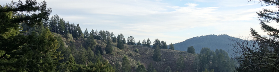
Russian Ridge Preserve
This 3,137-acre preserve known for its showy display of wildflowers in spring. In summer, the hills turn to gold with the late evening sunlight. Autumn, when the fog recedes, is the ideal time to enjoy the ridge views of San Francisco Bay and the Santa Cruz Mountains through the crisp, clean air.
Location: Google Maps Link
Directions:
Located on the northwest corner of the Skyline Boulevard (Highway 35) and Page Mill / Alpine Road intersection (across Skyline Boulevard on the right).
Additional parking is located at the Caltrans vista point opposite Russian Preserve gate #RR01 on Skyline Boulevard.
Project Lead: tbd
Additional Information: Participants should bring water, sunscreen, sturdy shoes, lunch and normal precautions against poison oak exposure (work gloves, long sleeved shirts and long pants). The Trail Center provides tools, training, gloves, and refreshments after the workday.
PCT in Shasta-Trinity National Forest
As many of you know, the Trail Center has a summer tradition of working a long weekend on the Pacific Crest Trail. We have worked at Sonora Pass, Ebbetts Pass, Sierra Buttes, and other locations. In 2019 we go north! We have a preliminary plan for work July 25-28. Access to the PCT will not be available until mid to late June, so we cannot be too specific until we see what the heavy winter snows have brought.
Location: We will work on a stretch of trail in the Shasta-Trinity National Forest (PCT miles 1526-1549). This is an area due west of Mt. Shasta and 20-30 miles west of I-5. We expect there to be a number of downed trees, erosion from the Spring water runoff and other common trail maintenance jobs. There is the possibility of improving a side access trail to a spring which serves as a water source for PCT thru hikers. This section of the PCT has fantastic views of Mt. Shasta, the Trinity Divide and Mt. Eddy. It will be prime time for thru hikers transiting the area.
We will camp at Picayune Lake, a small lake located about 1.5 miles from the PCT trailhead, altitude 6100 feet.
Windy Hill Open Space Preserve
Windy Hill is named for its distinctive, breezy grass-covered hilltop, which can be seen from many areas of the peninsula. The 1,335-acre preserve features open grassland ridges and forests of redwood, fir, and oak.
Location: Google Maps Link
Directions:
From highway 280: take 84 west to Skyline Blvd (highway 35); turn left and go 2.3 miles south to the parking lot on the left. (The first Windy Hill lot (Spring Ridge Trail trailhead) has no amenities so go on and around the bend and you will see picnic tables and a bathroom.) You can park on either side of Skyline, but be careful crossing the street if you are on the west side. Please follow any parking instructions given by Trail Center staff!
If you drive up Page Mill Road, turn right onto Skyline and go 4.9 miles north to the lot on the right.
From highway 92: go 15.5 miles south on Skyline Blvd; the parking lot is on the left.
Project Lead: tbd
Additional Information: Participants should bring water, sunscreen, sturdy shoes, lunch and normal precautions against poison oak exposure (work gloves, long sleeved shirts and long pants). The Trail Center provides tools, training, gloves, and refreshments after the workday.