Skip to content The Trail Center

This beautiful park has serene walking areas and trails leading to Sugarloaf Mountain. Laurelwood Park & Sugarloaf Mountain (225 acres) is the City of San Mateo's largest contiguous park and open space. This park contains a play area, picnic areas, and restrooms.

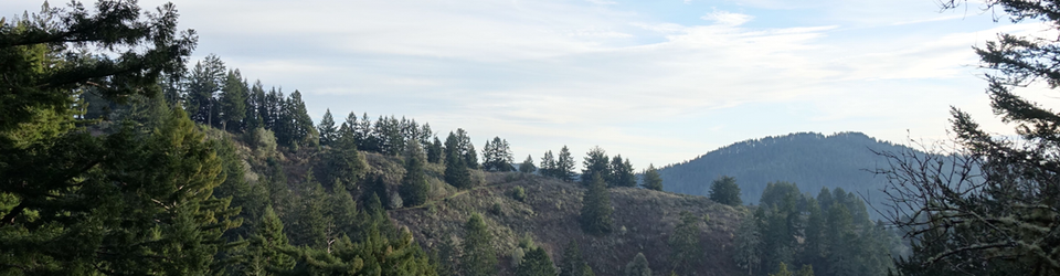
Sugarloaf Mountain is San Mateo's green thumb that sticks up just south of Hwy 92. It comprises of open space land that is largely undeveloped, either with homes or trails. There are five steep fire breaks that ambitious hikers use to get to the top for probably the best viewpoint on the mid peninsula.

In 2006 San Mateo developed an in depth master plan for trails on Sugarloaf Mountain with improvements to adjacent Laurelwood Park. In 2011 the city received a grant and highly renovated the playground, picnic area, and added a restroom to Laurelwood Park. But the Sugarloaf Mountain side of the plan was delayed indefinitely for lack of financing and priority. Tom Morse, a Trail Center member, approached the city about getting a trail built on Sugarloaf. By using volunteer labor and just the cost of materials, the City became interested. It took almost 3 years to go through the planning and political process, but finally we were given the "green light" to make this happen. The result was the Amphitheater Trail that climbs from the Tenderfoot Trail near the Laurelwood facilities to access the top of the mountain.

Our project will be to transform a social trail connecting a switchback of the Amphitheater Trail to the Salson Trail.

Park Web Page: Laurelwood Park - City of San Mateo Website

Location: Laurelwood Park/Sugarloaf Mountain, San Mateo, California

Directions: The park is located at 3471 Glendora Dr., San Mateo, CA.

From Interstate 280,take Hwy 92 east:

  • 2nd exit is DeAnza Blvd, exit then make a right turn to be heading downhill on DeAnza.
  • Park across the street from 1400 / 1404 DeAnza.
  • Walk down paved path to meet in front of restrooms.

From Hwy 101, take Hwy 92 west:

  • Take West Hillsdale Blvd exit, then make a left to go downhill.
  • Make a right at stop sign (Gendora Dr).
  • Make a left at first stop sign (Shasta Dr).
  • Follow Shasta Dr till it dead ends at bottom, be aware of red zone parking.
  • Walk down paved path to meet in front of restrooms.

Agency: City of San Mateo

Supervisor: TBD

Project Lead: Marilyn Green

Additional Information: Participants should bring water, sunscreen, sturdy shoes, lunch and normal precautions against poison oak exposure (work gloves, long sleeved shirts and long pants). The Trail Center provides tools, training, gloves, and refreshments after the workday.

Project: Alum Rock Park - City of San Jose

Photo Album: 1612 Alum Rock San Jose City Park

On Saturday, December 3, we had a huge turnout of volunteers and staff to work on the Sycamore Switchbacks Trail.

The weather was clear, with temperatures in the high 40’s at the outset and in the mid 60’s when the workday ended. Following November rains, the soil was quite workable. The work area was almost entirely under tree cover.

Volunteers parked in the Youth Science Institute lot, and Ranger Mike Peasland opened the gate at 8:00 am to allow Dave with the tool trailer and Lianna with the snacks to access the staging area at Sycamore Picnic Grove, immediately adjacent to the Sycamore Switchbacks trailhead.

Approximately 70 volunteers helped make the day a success. Matt and Bart from San Jose Parks and Recreation supervised 20 middle school students and their 4 accompanying adults, removing slough on South Woodland Trail during the morning. Three Trail Center crew leaders supervised the remaining volunteers (including 26 students from Santa Clara University) beginning at the lower trailhead of Sycamore Switchbacks Trail. Crew leader Dave C. was assisted by Kathy in the lower portion, Judd was assisted by Julio in the middle leg, and Woody was assisted by Larry at the upper end. Each crew had a similar scope: brushing, slough removal, definition of inside bench, repair of drain trenches and insloping at switchbacks, and fixing or adding drain dips as required. The work progressed up to Switchback 7 (the location of the seating benches and interpretive sign), approximately 0.4 miles from the lower trailhead.

The steep canyon wall, with the trail doubling back almost on top of itself, presented the potential hazard for dislodging rocks onto lower work areas. The crew leaders did an exceptional job of managing this risk by coordinating relative positions of the crews and staggering them when necessary.

We look forward to returning to Alum Rock to complete similar scope on the upper 0.3 mile portion of Sycamore Switchbacks Trail and possibly to brush South Rim Trail immediately east and west of its junction with Sycamore Switchbacks.
Thanks to Ranger Huy Mac for coordinating with us on this project, walking the whole route during scouting, promoting the event via the park kiosks, ensuring availability of the Sycamore Picnic Grove, and closing the trail during the work. Thanks also to Matt, Bart, and Ranger Mike for their help throughout the day.

Bill Farrell
12/06/2016

Project: Bay Area Ridge Trail - Saratoga Gap Open Space Preserve

Photo Album: 1611 Saratoga Gap OSP BART Service Day

On Saturday, November 5th, we had an absolutely great turnout of volunteers and staff to work on the Saratoga Gap Trail project. The weather was perfect, the logistics and planning paid off, and volunteers were busy all day moving rock, fixing tread and cleaning up this trail segment. At the end of the day everyone was tired but really satisfied with the new look of the trail.

Six crews were formed to address the work that was identified. Two headed south from our staging point, two headed north from this point, and two started at the Charcoal Road trailhead and worked south.

The staff of MROSD supplied us with lots of base rock to lay down and also with a couple of logs which were used as retaining walls.

The burritos arrived on schedule and everyone enjoyed one for lunch.

All critical areas on our list got attention and repair, and at the end of the day we celebrated with refreshments and a raffle.

I received many compliments about the project, and considering the size of the operation it went very smoothly.

Some details:
We had about 43 volunteers plus six crew leaders, a supervisor, three rangers, a burrito runner and representatives from MROSD, REI and BARTC. It was a full house. I wish to sincerely thank our crew leaders for a great job - Lisa Jewett, Dave Croker, Aaron Heiber, William Farrell, Judd Volino and Woody Collins. We couldn't have done this without their help. Thanks, too, to Kathy Diamond for organizing the volunteers. The staff from MROSD was extremely helpful, supplying planning, advice, logistics and equipment. We also wish to thank reps from REI, MROSD and BARTC for joining us at this event. And, of course, our burrito runner Susan.

Hank Magnuski
11/8/2016

Eighteen Trail Center volunteers spruced up the Mount Ellen Nature Trail in San Mateo County’s Memorial Park.  For a nature trail, it was quite challenging with steep parts and large roots obstructing the trail.  Dave Taylor was the day’s Trail Boss and he was assisted by Hank Magnuski, Judd Volino, and Larry Stites/Kathy Diamond as Crew Leaders.  The effort focused on general trail maintenance.  Plenty of duff and leaves had accumulated which needed to be removed.  Roots had been exposed in considerable numbers and needed to be removed or “topped off.”  Volunteers constructed a few drain diversions and a temporary trail diversion around a location which had, until recently, had a large Douglas Fir blocking the trail.  The Ranger, Dave Vasquez and a Ranger Aide, Mike, helped by constructing a step down from a particularly large root after this unsafe situation was pointed out.  Finishing off the day, all three teams joined up to create some new drainage diversions and fill in some gullies near the entrance to the trail.  Crushed rock from the temporary trail around the Doug Fir was repurposed to help fill in the troughs we decommissioned the temporary trail.

The day was beautiful and everyone got a good workout, even without extensive digging required.  All agreed that the trail network was confusing, but everyone found his or her way back down. Several locations were identified where retaining walls would be beneficial to get around large roots half blocking the trail.  This is a project for another day.  A special thanks to Bill Farrell who scouted and wrote up this and some pending Memorial projects and Judd who walked the trail help scout it out for the work day along with Dave.

Dave Taylor
9/21/16

Portola Redwoods has a rugged, natural basin forested with Coast Redwoods, Douglas Firs and Live Oaks. There are eighteen miles of trails, a 53 site campground, four group campsites and two beautiful creeks, the Pescadero and Peter''s Creek, that run throughout the park.

The Sequoia Nature Trail, which leads to the Pescadero Creek, introduces visitors to the natural history of the area.

Visitors should come prepared for any type of weather. The park receives between 40 and 60 inches of rain per year and the summer months can be foggy and cool. Layered clothing is recommended at any time of the year.

Location: Portola Redwoods State Park, San Mateo County, California - Upper Coyote Ridge Trail (northern end)

Directions: From Highway 35, turn west onto Alpine Road. From the point at which you start on Alpine Rd. from Skyline Blvd., go 3.4 miles to a Y-intersection. At this intersection, DO NOT follow the sign to the left towards Portola Redwoods SP. Instead, bear right, continuing on Alpine Rd. for another 0.4 mile to the junction with Buffalo Valley Drive. At that point, continue STRAIGHT onto Camp Pomponio Rd. (you'll see a sign for Pescadero Creek County Park) which becomes narrow and rough, for 0.9 mile until reaching the gravel Tarwater Trailhead Parking lot on the left side of the road.

View destination on Google maps

Due to mountain roads, expect a 1 to 1 1/2 hour drive from most Bay Area locations. There is no gasoline available at or near the park. There is no store in or near the park.

Agency: California State Parks - Chris Pereira, Supervising Ranger

Supervisor: Judd Volino

Project Lead: Judd Volino

Additional Information: Participants should bring water, sunscreen, sturdy shoes, lunch and normal precautions against poison oak exposure (work gloves, long sleeved shirts and long pants). The Trail Center provides tools, training, gloves, and refreshments after the workday.

Assemble at 8:30 a.m. for our safety talk and crew assignments. Work begins at 9:00 a.m.

Park Home Page (external link)

Project: Portola Redwoods State Park (Upper Coyote Ridge Trail)

Photo Album: 1608 Portola Redwoods

We revisited our destination of a year ago by working in Portola Redwoods State park on August 20, 2016. Two crew leaders, Hank and Bill supervised 21 volunteers, including six young men from Camp Glenwood.

The team covered about 0.7 of a mile of the 1.3 mile long Upper Coyote Ridge trail in order to address low and high vegetation, poison oak, and slough and bring back a more comfortable tread width throughout. We staged from the Tarwater Trailhead in Pescadero Creek County Park, at the north end of the trail. We were fortunate to work mostly under tree cover.

The work day leaders prioritized working on areas of the trail where the tread narrowing was forcing hikers to the outside edge of the trail and where the highest concentrations of poison oak were encroaching. Bill's crew began by completing much brushing, grass and berry vine removal from the westward facing vista area about 0.6 mile down the trail. Later they continued south at the next most needy areas, again primarily removing vegetation that had overgrown into the trail corridor and attacking patches poison oak.

Hank's crew started about 0.9 mile down, where the trail is situated right on the ridge and there are a number of switchbacks. This part of the trail needed mostly slough removal and tread restoration along with brushing. All of the critical tread was completed save for a small section where a retaining wall may be needed due to tree roots and a steep hill slope. A pair of volunteers did all the brushing to the junction with the two branches of the "lower" Coyote Ridge Trail.

We look forward to returning to Portola Redwoods sometime after the turn of the year to complete some outstanding retaining wall projects on the Slate Creek Trail. Perhaps we can also revisit the Upper Coyote Ridge trail to fine tune the tread when the soils have more pliability and perform additional low vegetation removal, particularly in the northern 0.6 mile that includes part of Pescadero Creek County Park.

Thanks to Ranger Tyler Knapp for coordinating with us on this project, walking the whole route during scouting, ensuring availability of the trailhead parking lot and for visiting to thank volunteers at the end of the work day. We also appreciate the continued support from Santa Cruz District Trail Supervisor Chris Pereira.

Judd Volino
8/25/2016

Project (click for directions): Tool Party and Annual Meeting

Tool Maintenance and Trailer Cleanup

Activities: Work will start around 10:30 or 11:00 a.m. and continue until done. The Annual Meeting is planned to start at 4:00 pm. Pizza's on at 5:00 pm. Snacks are provided and there will be a special presentation at the end of the day.

Volunteer

Project: Coyote Point Recreation Area

Coyote Point Bay Trail

Activities: We will wrap up work on a reroute of a trail to make the "run-down-the-hill" use trail safer at San Mateo County's Coyote Point Recreation Area, behind CuriOdyssey. This work day will have a small volunteer limit, as we'll be focussed on constructing a retaining wall above a portion of the staircase we built in the summer of 2017. There may be some tread touch-up work as well.

Volunteer

Bay Area Ridge Trail - REI Service Day

Activities: Due to the Trail Center's persistent efforts in the last several years maintaining the portions of the Bay Area Ridge Ridge Trail in the Skyline Boulevard region, we found there was not a contiguous area which would provide sufficient work for a large group this year. Therefore, we are recommending that volunteers who wish to work on the Ridge Trail this year sign up for an event at the various sites being organized by other agencies and groups. Trail Center will provide a few crew leaders to help out Midpeninsula Regional Open Space District at its project in Skyline Ridge Open Space Preserve in Los Altos, if you wish to join some fellow Trail Center folks there.

Visit the BARTC's EventBrite page to review available projects and sign up. (Use the "Tickets" button to register, but be assured the work day projects themselves are free.)